Topic:
The maps below indicate the changes to the downtown area of a town called Hanford over a 50-year period. Summaries the information by selecting and reporting the main features, and make comparisons where relevant.
My essay:
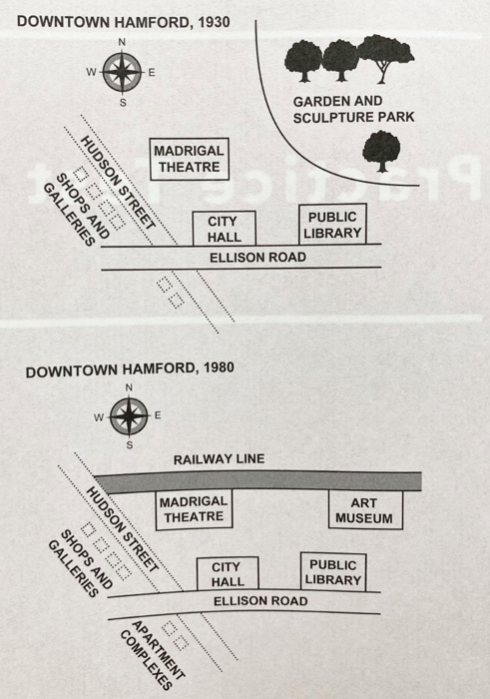
The two maps illustrate how the downtown region of Hanford changed from 1930 to 1980.
Overall, this town has drastically changed and urbanized over a half century.
In 1930, there were a large garden and sculpture park in the northeast. In the south, a horizontal road called Ellison was situated with a city hall and public library alongside to it.
Another pathway, Hudson street, went down from west to south crossing beneath the other road. On one side of Hudson street, shops and galleries were located, and a madrigal theater was placed on the other side.
50 years later, the garden and park were completely demolished so as to construct a railway line in the north connecting to Hudson street. A new art museum and the theater were placed adjacent to this railway.
Alongside Hudson and Ellison roads remained relatively the same; however, a bunch of apartments was built between these two in the southwest area.